Nepal: One year later, looking back at lessons learned on rapid assessment of earthquake damage of April 25, 2015
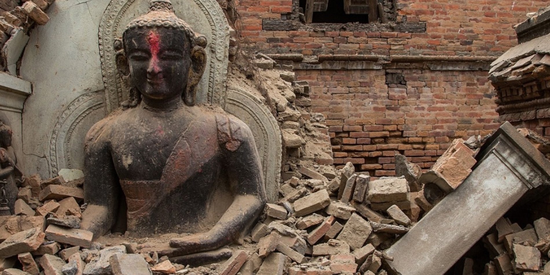
A little over a year ago one of the most destructive earthquakes in recent history killed 9,000 people in Nepal. It leveled entire towns, reduced ancient temples to rubble and set off an avalanche that buried 21 climbers on Mount Everest, making April 25, 2015, the deadliest day ever on the mountain.
The 7.6 magnitude temblor was centered in Nepal’s historic Gorkha district, birthplace of Nepal’s second king and home of the legendary warriors of the British Empire.
The country was thrown into chaos. Humanitarian organizations quickly arrived to distribute life-saving supplies of water, food and blue tarps for makeshift shelters. But landslides cut access to many remote villages that suffered extensive damage. Search and rescue teams that rushed to the scene struggled to find people trapped in some 500,000 buildings that collapsed during the quake.
In the immediate aftermath of the disaster, a team of engineers from the Stanford Blume Earthquake Engineering Center built a cloud-based computing model to estimate the earthquake’s impact on the region. Though the team members – Jack Baker, associate professor of civil and environmental engineering, and PhD students David Lallemant and Maryia Markhvida – were far from the fatal quake when it struck, their modeling work was used to plan recovery on the ground.
“Such models produced in the days and weeks following a disaster are a key information tool to support early decision-making for relief and recovery,” says Lallemant. “Strong earthquakes affect very large areas and it takes a long time before we get a clear picture of the extent of the damages, fatalities and so forth. A lot of decisions have to be made before we get that clear, on-the-ground understanding from field surveys.”
Recovery efforts rely heavily on models such as the one he and his colleagues built for Nepal to grasp a sense of the magnitude of expected losses and where those losses likely occurred. Lallemant and Markhvida’s rapid impact assessment model relied on a series of elements put together with support from Google’s Earth Engine team. The model used the ShakeMap produced by the U.S. Geological Survey Earthquake Hazards Program. The ShakeMap provided near-real-time map estimates of shaking intensity in Nepal.
In addition, the model incorporated NASA’s Digital Elevation Models to investigate local shaking amplification related to the terrain. The researchers also applied geospatial data describing where people live, where buildings exist and the vulnerability characteristics of those buildings. The team developed and analyzed detailed models of Nepali buildings in earthquake conditions to understand their susceptibility to damage and determine the scale and spatial distribution of destruction, as well as the probability distribution of fatalities.
After large disasters, affected governments often appeal for international assistance. Toward that end governments ask the World Bank, the United Nations, the European Union and other entities to assist them in conducting a post-disaster needs assessment (PDNA). That assessment establishes the broad scope, approach and principles of recovery, and becomes the basis for a global appeal for assistance. Because PDNAs must be done before detailed impacts are fully quantified, they are far from perfect. In the case of Nepal, the Stanford model and other sources of information used in compiling the PDNA had some inaccuracies, but in the throes of crisis response, agencies want to know that their estimates are based on state-of-the-art techniques.
This model and others were used to begin planning the strategy for assistance to the government of Nepal. Lallemant served as one of the international co-leads for the housing sector assessment and preliminary recovery strategy for the PDNA. He applied the Stanford impact model along with damage surveys from Nepal’s Ministry of Home Affairs to estimate the scale and geographic distribution of damages and the needs for reconstruction of broken homes. “Working closely with Nepali authorities, we estimated that the housing sector had been hit hardest, with nearly 500,000 homes destroyed, representing 50 percent of the country’s total losses, at a cost of $3.5 billion,” says Lallemant.
Meanwhile, other Stanford students from the Blume Earthquake Engineering Center volunteered their time and curated a virtual earthquake clearinghouse hosted by the Earthquake Engineering Research Institute. On the website, the students collected the most relevant news, pictures and technical data for those working on recovery in Nepal. They also developed a report on building damage for the World Bank and United Nations to determine why buildings collapsed and gave recommendations for safe reconstruction. “Stanford has a long history of leadership in earthquake risk science and earthquake engineering research,” says civil and environmental engineering professor Greg Deierlein, director of the Blume Earthquake Engineering Center.
Among other initiatives, Stanford and the Pacific Earthquake Engineering Research Center pioneered the Performance-Based Earthquake Engineering methodology. The idea is to use reliability analysis to match the design of structures with target performance goals, often far beyond the minimum requirements of the building code. The methodology can be applied to designing all sorts of resilient buildings from urban skyscrapers in major cities to low-cost housing in poor countries.
More recently, Stanford researchers have developed methods to quantify the risk of entire cities dynamically in time, in order to see how risk changes with patterns of urbanization and construction. Prior to the earthquake in Nepal, this work had demonstrated the alarming increase in earthquake risk of the Kathmandu Valley due to rapid urbanization and incremental expansions to buildings. Now, looking back on the aftermath of the 2015 quake, the Stanford researchers hope that their work can be applied proactively. “As Nepal plans and implements a recovery program that will take many years, such dynamic risk-modeling tools can help the country choose a path toward a more resilient future,” says Lallemant.
- Source: Stanford Engineering/Corey Binns
https://engineering.stanford.edu/news/how-do-you-recover-after-deadly-e…


